10 Amazing Beaufort Sea Facts
The Beaufort Sea is a marginal sea of the Arctic Ocean, north of the Northwest Territories, the Yukon, Alaska and west of Canada’s Arctic Islands.
It is named after hydrographer Sir Francis Beaufort. The Mackenzie River, the longest river in Canada, drains into the Canadian part of the Beaufort Sea, west of Tuktoyaktuk, one of the few permanent settlements on the sea’s shores. Other important rivers that empty into the Beaufort Sea are the Kongakut River in Alaska and the Firth River in Yukon.
Read along to learn 10 interesting facts about the Beaufort Sea.
1. Contains significant petroleum and natural gas resources
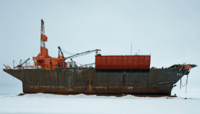
The Beaufort Sea has many petroleum and natural gas reserves, such as the Amauligak field. These reserves were found between the 1950s and the 1980s, and since then, resource exploration has become a major activity in the region.
It was estimated to contain around 250 km3 of oil and 300,000 km3 of natural gas when first explored in the 1950s. Offshore drilling commenced in 1972, and 70 wells were up by the 1980s, which rose to 200 by 2000. Hence, around 46.5 million m3 of soil was dredged. Around 50,400 m3 of oil was produced in 1986.
Taglu Gas field was found in the Mackenzie River Delta in 1971, followed by the Parson Lake and Niglintgak fields. The estimated gas reserves of these fields include 58,600 km3, 35,400 km3 and 13,600 km3.
The Amauligak field is the biggest known oil reserve of the sea, found in 1984, and is estimated to have 37.3 km3 of oil and 38,500 km3 of gas. However, development is hindered by the remote locations of these deposits.
In 2017, the U.S Bureau of Ocean Energy Management allowed Eni, an Italian multinational oil and gas company, to drill 4 oil exploration wells on Spy Island, one of the 4 artificial islands in the Beaufort Sea.
2. Has a Complex Geography
Many rivers, like the Kongakut River in Alaska and the Firth River in Yukon, drain into this Sea. The major river that flows into it is the Mackenzie, also the longest river in Canada. Its coastal shelf is narrow, especially east of Point Barrow in the Alaskan part of the Beaufort Sea. One major underwater feature here is submarine valleys. The Sea becomes broader near the Mackenzie River delta but does not exceed 145 km.
Closer to the coast, the depths are shallower than 60 m, but they rapidly increase northwards up to a few km, changing into a big platform similar to that of oceans.
There are several islands in the Beaufort Sea and the Mackenzie River Delta. Some big ones lie west of the Mackenzie River, like Herschel Island, which is just 4 km from the shore. Barter Island is 03 km from the coast and spans 13 km2. The Beaufort Sea coasts are low; maximum elevations range from 250 to 750 m.
The soil remains frozen throughout the year, and at a depth below a metre or even less, it forms permafrost. Just a few centimetres thaw in the short summers. This is why buildings are elevated above the ground on wooden piles immersed in the permafrost.
3. Border Dispute between Canada and the U.S
An ongoing border dispute between Canada and the U.S involves a wedge-shaped part of the Beaufort Sea in the Arctic Ocean. The disputed region is called the Beaufort Sea Triangle or the Beaufort Sea Wedge. It covers an area of 21,000 square kilometres.
The issue centres around where the maritime border between the two nations should be drawn in the region. Canada claims the boundary should be as per the 141st meridian west, and the US claims it should deviate slightly east of that line.
The border issue is important for Canada and the U.S. because as the ice melts due to global warming and more of the sea opens for navigation, it will open new fishing and resource development opportunities. Control of the Beaufort Sea waters in the disputed region has economic implications for both parties.
Canada and U.S have negotiated the dispute since the 1970s. However, they failed to reach an agreement on the same and periodically tried to affirm their claims. The disputed wedge is not clearly delineated on official maps issued by both.
4. No large-scale commercial fishing allowed
In 2009, the U.S Secretary of Commerce announced a moratorium on fishing the Beaufort Sea north of Alaska. It was imposed because it was argued that once global warming made those waters available for commercial fisheries, they would be exploited, threatening the fragile ecosystem. Hence, the need to develop a plan for sustainable fishing was emphasised.
There are no widespread commercial fisheries in the waters now. This decision stirred controversies in Canada as the region where the USA announced the moratorium is a massive wedge-shaped part of the disputed waters.
Due to limited scientific research and evidence, the moratorium is in place to preserve the region’s fish stocks that are yet not fully understood. Many fish species are data-poor.
It will stay in place until more research on fish populations and the ecosystem impacts are identified. This would help determine sustainable catch levels if commercial fishing is allowed.
However, subsistence fishing by the native communities continues in the Beaufort Sea under the Moratorium since it is on a very small scale using traditional techniques and has a minimal ecological footprint.
In 2014, the Government of Canada further announced that no commercial fisheries would be considered in the Beaufort Sea until research shows sustainable stocks that would be available to the Inuvialuit first.
It also designated parts of the Beaufort Sea as Marine Protected Areas. One such is the Anguniaqvia niqiqyuam, and it encloses the Parry Peninsula in the Amundsen Gulf. Another one is Tarium Niryutait, situated at the Mackenzie River delta and estuary. These marine protected areas were established to protect the flora and fauna of the region, the different native species and habitats for the Inuvialuit community.
5. Remains frozen throughout the year
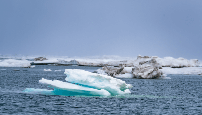
The Beaufort Sea is frozen most of the year, except for August and September, when ice breaks near its coast and opens an area that was once a 50- to 100-km-wide strip of open water. In the 2000s, climate change in the Arctic expanded the ice-free area.
Channels of Mackenzie River thaw early, in May and June. The thawing increases the average water discharge from 150,000 to 250,000 m3/s. Some new changes were identified in the Beaufort Sea’s ice cover in 2009. Though ice is stable, and so are water temperature and salinity, the ice structure has changed. The new ice, called rotten ice, is thinner and weaker.
6. The seawater is separated into 4 distinct layers
The Beaufort Sea water has four different layers. The top layer is 100 m, which is the surface water with a temperature of -1.4 degrees Celsius in summer and -1.8 degrees Celsius in winter. The second layer is formed by inflows from the Pacific Ocean and the Bering Sea, with waters coming through the Bering Strait.
The warmest and the deep Atlantic layer has a temperature between 0 and 1. The water at the bottom is colder at -0.4 degrees Celsius and -0.8 degrees Celsius. Average salinity lies between 28-32% parts per thousand going from the south to the north. Air temperatures are -27 degrees Celsius in January and 11 degrees Celsius in July.
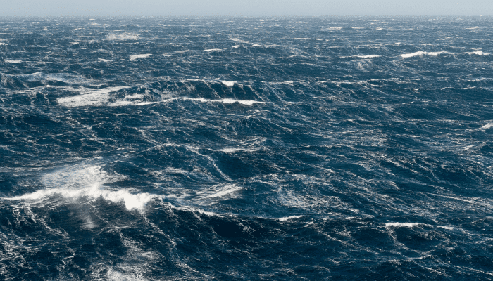
The water currents form the Beaufort Gyre, which results in south-westerly and westerly currents close to the shores. The Mackenzie River also affects this circulation, which induces minor eastward steams close to its mouth. The river brings around 15 million tonnes of sediments rich in dolomite and calcium carbonate. Those deposits are spread over the sea and are mixed with gravel and mud.
7. The shoreline of Beaufort Sea marks the limit of polar bears in North America
The coast of Beaufort Sea is covered with tundra and is the northern limit of North America’s terrestrial range of polar bears. The Mackenzie River is a vital habitat for seabirds and whales and is untouched by commercial traffic. Its delta has many ponds and lakes inhabited by muskrats.
Around 80 species of zooplankton, over 70 species of phytoplankton and around 700 species of bryozoans, molluscs, and crustaceans; however, their population is small due to the cold climate.
The eastern part of the Beaufort Sea is home to Beluga whales. Their population is stable and might even increase.
It is not affected by offshore oil exploration in the region. Belugas spends summer in the coastal areas and the Mackenzie River delta, both ice-free at this time. In winter, they migrate to the polynyas of the deep sea. Research shows that the belugas of the Beaufort Sea are different from those of other Canadian and Alaskan waters despite sharing a similar habitat.
8. Has a simple food chain
The food chain of the Beaufort Sea is relatively simple. It begins with algae and phytoplankton, the energy source for zooplankton and coastal amphipods, which are food for fish like the polar cod, Arctic char, and seabirds.
Polar cod is food for arctic char, narwhal, seals and belugas. Bearded seals and walrus feed on benthic invertebrates. The Polar bear lies on the top of the food chain, mainly feeding on seals and large marine mammals.
Major fish species found in the Beaufort Sea include polar cod, arctic cod, arctic char, saffron cod, arctic cisco, lake whitefish, pacific herring, broad whitefish, inconnu, flatfish, fourhorn sculpin, etc.
9. Has a history of occupation going back to 4000 years
Evidence suggests that Paleo-Eskimos arrived on the Beaufort Sea coast around 4000 years ago. There was the Dorset culture, the Thule, and the modern Inuit. In earlier times, they engaged in fishing. Thousands of years old fish bones were found in historic settlements. The people lived a nomadic life and formed permanent settlements much later.
These communities still thrive on these coasts. Their population is rising; however, there is a lack of jobs, and youth prefer to move abroad for employment and better living conditions.
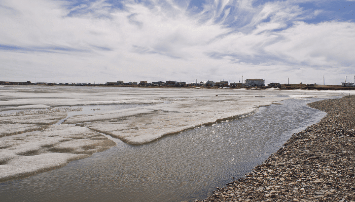
Tuktoyaktuk, Canada and Prudhoe Bay, Alaska, are two major settlements along the Beaufort Sea. Tuktoyaktuk is an Inuvialuit hamlet near the delta of Mackenzie River in the Inuvik Region of the Northwest Territories. It is north of the Arctic Circle on the shores of the Arctic Ocean and is the only place in the Arctic connected to other parts of Canada by roadways. It was known as Port Brabant after British colonisation, and in 1950, it became Canada’s first indigenous settlement, which reclaimed its traditional name.
Prudhoe Bay lies in North Slope Borough in the U.S. state of Alaska. People living there are usually fishermen and mine workers employed in the oil companies. Most of them work at the Prudhoe Bay Oil field, the largest oil field in North America. It lies in the coastal lowland on the Northern Slope.
Some tourists arrive here from Fairbanks by bus or private vehicles to see the tundra, the midnight sun, and the Arctic Ocean. Prudhoe Bay was named by British explorer John Franklin after his classmate Captain Algernon Percy, Baron Prudhoe.
10. Has artificial islands
Many islands lie in the Beaufort Sea. While some of them are natural, others are artificial and came up to meet the needs of the oil drilling industry. Two such man-made islands are Endicott and the North Star Islands. The former was set up in 1987, and the latter was set up in 2001 to enable effective oil drilling. The crude oil is transported to Port Valdez through the Trans-Alaska Pipeline System.
The Beaufort Sea is experiencing pollution due to oil spills during shipping and oil drilling processes, harming its pristine environment. Some rivers that empties into the sea also carry the chemicals and refuse that pollute it further.
This has led to a decline in the marine population. Another reason for the decline was hunting, especially of Bowhead whales, between the late 1880s and 1914. However, laws were brought to stop hunting as the populations of these majestic mammals declined rapidly. Regulations like curbs on fishing have helped protect the threatened species in the Beaufort Sea.
You might also like to read-
- Difference Between Gulf And Bay
- 10 Major Sea Routes of the World
- 8 Major Ports of Marshall Islands
- 10 Longest Fjords In The World
- 10 Major Ports Of Greece
Disclaimer: The author’s views expressed in this article do not necessarily reflect the views of Marine Insight. Data and charts, if used in the article, have been sourced from available information and have not been authenticated by any statutory authority. The author and Marine Insight do not claim it to be accurate nor accept any responsibility for the same. The views constitute only the opinions and do not constitute any guidelines or recommendations on any course of action to be followed by the reader.
The article or images cannot be reproduced, copied, shared or used in any form without the permission of the author and Marine Insight.
Do you have info to share with us ? Suggest a correction
Latest Maritime Knowledge Articles You Would Like:
Subscribe To Our Newsletters
By subscribing, you agree to our Privacy Policy and may receive occasional deal communications; you can unsubscribe anytime.
Web Stories

About Author
Zahra is an alumna of Miranda House, University of Delhi. She is an avid writer, possessing immaculate research and editing skills. Author of several academic papers, she has also worked as a freelance writer, producing many technical, creative and marketing pieces. A true aesthete at heart, she loves books a little more than anything else.


